Gehistoriseerde kaart van Australië en Nieuw-Guinea
Abstract
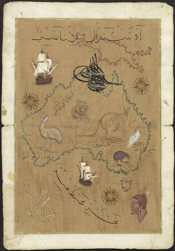
From a collection of so-called ‘Crusader Maps’ – modern Turkish interpretations of Western and Ottoman maps made for the tourist market. The maps are painted on much older folios taken from handwritten books; the verso sides are still in their original condition and contain old Ottoman script. The collector Kok bought these cards as curiosities in the Grand Bazaar in Istanbul.
| Subject | Maps |
| Art objects | |
| Turkish language | |
| Coasts–Australia | |
| Papua New Guinea | |
| Category | 6. End of the Cold War |
| Place Of Publication | Istanbul |
| Keywords | tourism |
| geography | |
| Current Holder | Nationaal Archief |
| Date | 1980 |
| Item Number | MC233.19 |
| Access Rights | Digitised |
| Country Of Origin | Turkey |
| Language | Turkish |
| Description From Source | MC233.1-.29 Verzameling zogenoemde ‘Crusader Maps’ (kruisvaarderkaarten): voor de toeristische markt vervaardigde moderne Turkse interpretaties van westerse en Ottomaanse kaarten ca. 1980-1990 29 bladen Gouache, gekleurd De kaarten zijn geschilderd op veel oudere folio’s afkomstig uit handgeschreven boeken; de versozijden zijn nog in originele staat en bevatten oud Ottomaans schrift. De kaartbeelden, die veelal teruggaan op klassieken uit de geschiedenis van de Ottomaanse en westerse cartografie, zijn vergezeld van allerlei illustraties, zoals schepen, zeemonsters, dieren, menselijke figuren en portretten, gebouwen, monumenten en instrumenten voor navigatie en landmeting. Op enkele exemplaren komt een tughra (gekalligrafeerd monogram) voor. Kok kocht deze kaarten als curiositeiten in de Grand Bazaar te Istanboel. |
| Physical Format | Maps |
| Drawing |
Related files
Post successfully! Your comment will appear after it has been approved by the admin.
Log In to add your own notes to this record.
Saved to collection